<< Back to Old Photographs Page
Old Photographs of Troopers Hill
Set F
Along the Avon Valley
Conham Hall

This photograph of Conham Hall was passed to us by Ruth Coleman after our Avon Valley Walk in September 2012.
Conham Hall stood to the west of the track from Beeses ferry to the bend at the bottom of Conham Hill. We are not sure of the date of the photo, but it was probably taken not long before Conham Hall was demolished in 1971. To the right of the house in the photo you can see the monkey puzzle tree that still stands near the track.
You can see Conham Hall on old Ordnance Survey maps using Bristol City Council's excellent Know Your Place website at www.bristol.gov.uk/knowyourplace (even though it is actually just outside the City boundary).
Tar Works Oil Boom

This structure was at the end of the boom that was used to restrict the spread of oil from the works down the River Avon in the event of spils. Many thanks to Raymond Holland for giving us permission to use this photograph.
The Lamb Inn, Crews Hole Road
Then and Now - Click on dates to change view
1920s | 1940/50s? | 1985 | Mar 2007 | Dec 2012 | Jan 2013 | Feb 2014 | Mar 2015 | Oct 2015
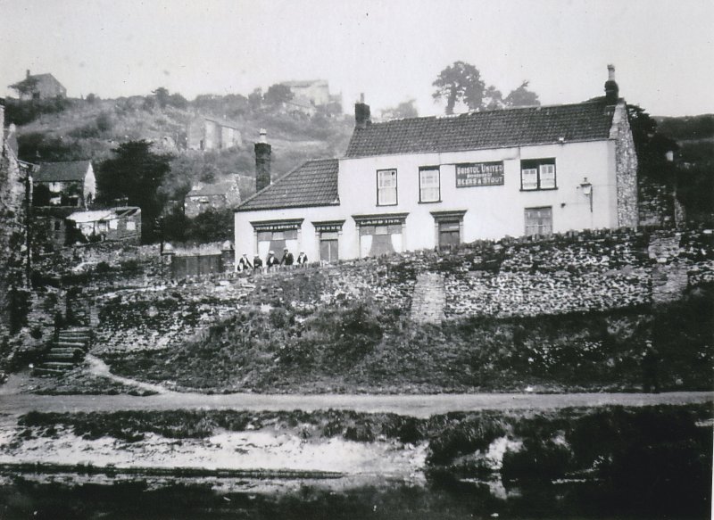
The Lamb Inn probably dated from the 1700s, in 1985 it was in use as offices but by the late 1990s was derelict. A planning application for its demolition was refused in September 2007. In 2012 an application was approved to convert it into two houses and to build new houses in the garden and on the adjacent site. The intention was to remove the parts of the structure that were unstable and the parts of the walls that were beyond repair. Unfortunately none of the structure was found to be sound and the building had to be taken down to ground level. Following changes to the planning conditions work to build two houses on the same footprint started early in 2015.
The 1940/50s photo above is undated, but must be from around that time, note that the window arrangement has changed from the 1920s and is the same as in 1985.
Thanks to George Elliott for the 1920s &50s photos and to Dave Cheesley of Barton Hill History Group for the 1985 photo - see the BHHG website at www.bhhg.co.uk
Board Mills Watar Pumping Station
17 July 2006 Then and Now - Click on dates to change view 09 Sept 2007
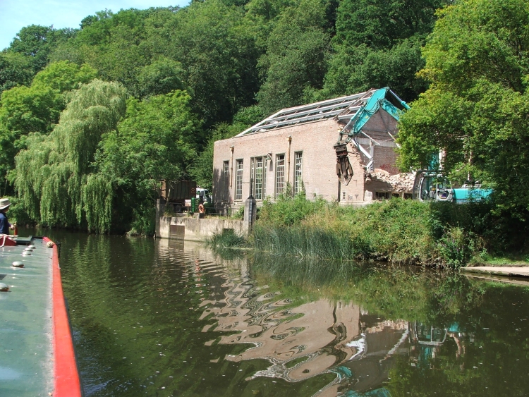
Although taken only recently this photo shows a structure which was part of the landscape of the Avon Valley for many years. It was the intake for the water treatment works attached to St Anne's Board Mills. In 2006 work was just starting to 'restore' the building for use as apartments. The finished building actually looks quite attractive and at least reflects the spirit of the original.
The Board Mills from Troopers Hill Woods
1980s Then and Now - Click on dates to change view 2007
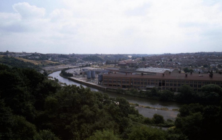
This is another view that shows the dramatic changes that have taken place in the Avon Valley in the last 30 years. The lower parts of Troopers Hill can also be seen and again the recent increase in trees and shrub is very clear. Both the 1980s and 2007 photographs are copyright Jonathan Lane. Thanks to Jonathan for sending these to us and allowing us to use them, more of Jonathan's photographs can be seen in his flickr set.
The Wesleyan Chapel of 1860 in Crews Hole
Then and Now - Click on dates to change view
Early 1990s | c2001 | Feb 14 | July 2020
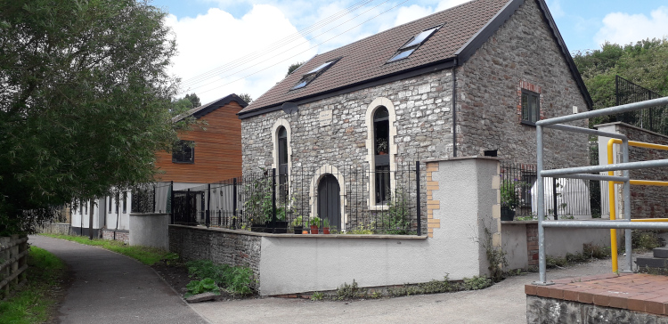
The older views show the engineering works that were built around the Wesleyan Chapel in Crews Hole. The Lamb Inn can be seen behind. The first photos were taken by Roy, as you can see the 1990s view (or it might be late 1980s) is made up from two images and was taken as work was starting to refurbish the works.